Forecasting & alerts
Google’s crisis alerts provide access to trusted safety information across Search, Maps, and Android.

Crisis alerts
The most critical information, delivered when you need it most.
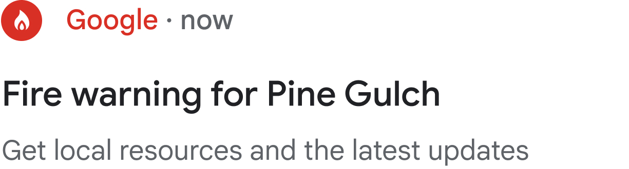
SOS notifications from Google
When you’re in a location affected by a disaster, you may receive a notification from the Google app directing you to an SOS Alert on Search where you’ll access credible safety information.

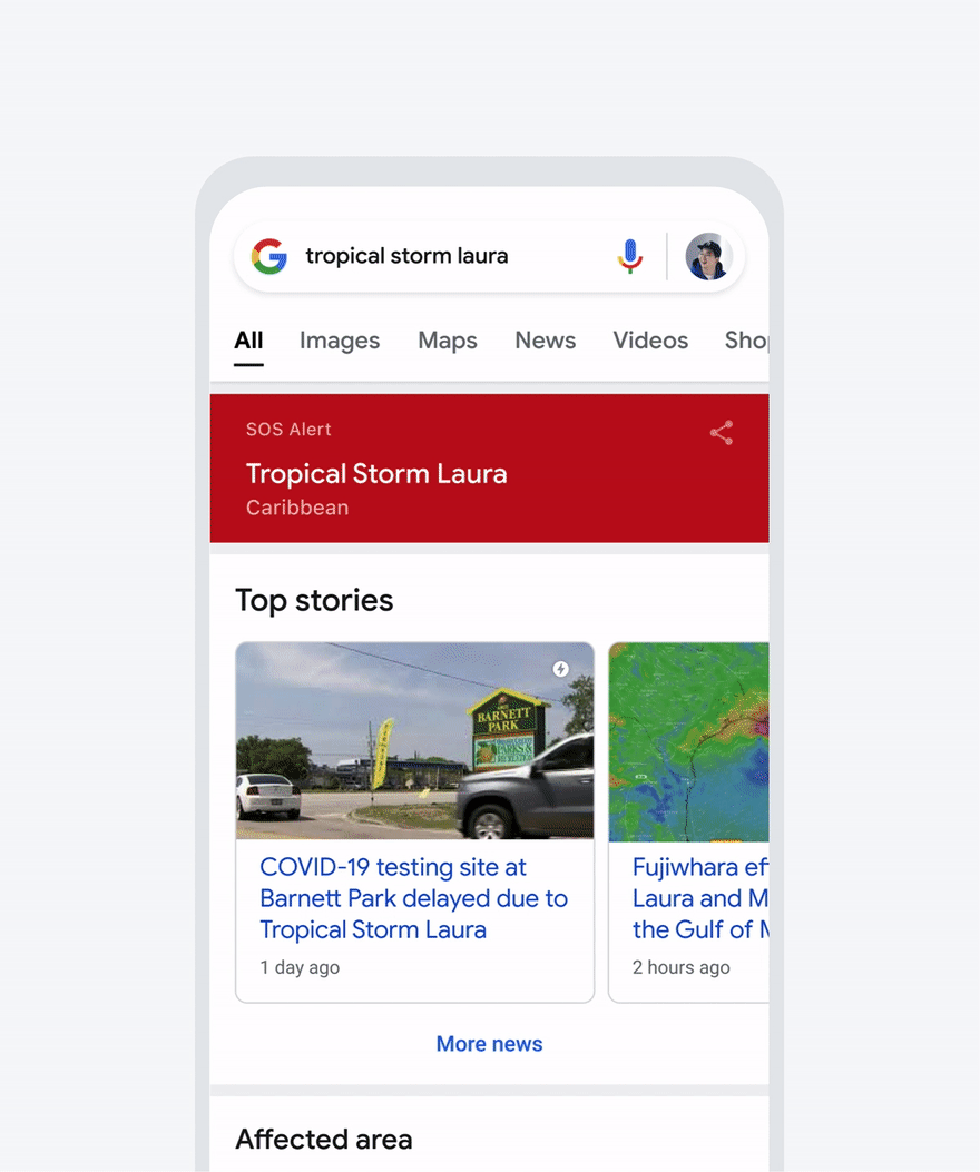
SOS Alerts on Google Search and Maps
SOS Alerts on Search and Maps surface relevant and ongoing updates from official sources, including local authorities and emergency response organizations.

SOS notifications from Google
When you’re in a location affected by a disaster, you may receive a notification from the Google app directing you to an SOS Alert on Search where you’ll access credible safety information.
SOS Alerts on Google Search and Maps
SOS Alerts on Search and Maps surface relevant and ongoing updates from official sources, including local authorities and emergency response organizations.
Interactive maps
People can quickly access an interactive map where they can see their location relative to the predicted flood.
Google.org is supporting the International Federation of Red Cross and Red Crescent Societies to build local networks that can get flood alert information to those without access to devices or internet connectivity.
Real-time flood forecasting
Through partnerships with local governments, we’ve developed real-time flood forecasting models that predict when and where a flood might occur, along with its severity.

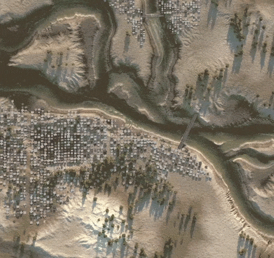
Improved visualizations
Using data from NOAA’s satellites and the computing power of Google Earth Engine, we’re able to detect an active wildfire and produce an approximate boundary on Google Search and Maps.
Google.org continues to support wildfire response and recovery efforts through grants towards initiatives including crisisready.io and the forestry and fire recruitment program.
Infrared + optical imagery
Built using Infrared technology and optical imagery to identify “hot spots,” wildfire boundary maps are accompanied by safety information from local authorities including shelters and evacuations.
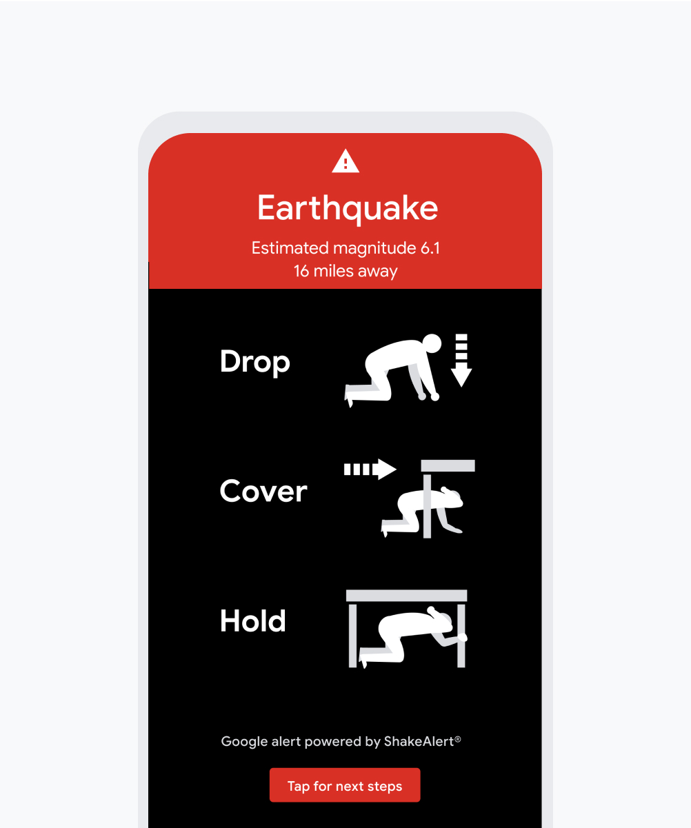
Earthquake alerts
We've partnered with ShakeAlert® to send earthquake alerts directly to Android devices in California, Washington, and Oregon. Outside the U.S. earthquake alerts are powered by the Android Earthquake Alerts System.
Developed by the nation’s leading seismologists, ShakeAlert® uses signals from 700+ seismometers.

Android Earthquake Alerts System
Traditional seismometers aren’t available in many parts of the world, so we’ve developed the Android Earthquake Alerts System which uses Android phones like mini seismometers to create the world’s largest earthquake detection network.
Detailed forecast cones
In the days leading up to a hurricane, detailed forecast cones from authoritative sources appear on Google Search and Maps that show the storm’s predicted trajectory.
425M+
views of crisis alerts for hurricanes since 2017
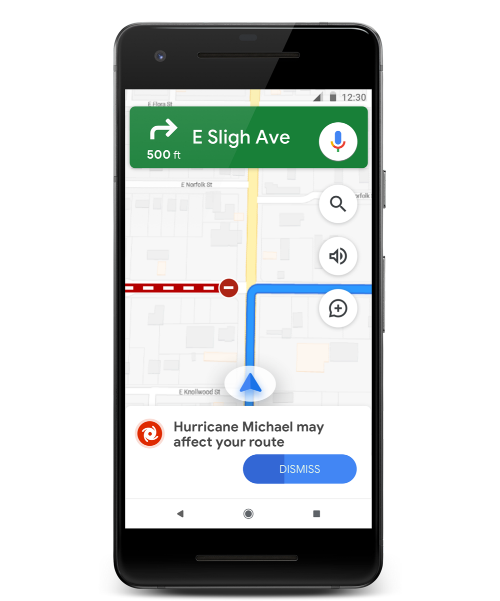
Timely navigation warnings
Within Google Maps you’ll see a prominent alert if your route may be affected by storm activity—and we’ll keep road conditions up to date so you can navigate safely.
Encouraging individual safety while improving access to emergency services.
Personal safetyEnsuring effective post-disaster relief and supporting long term recovery and resilience.
Recovery & resilience